Last year, in honor of GIS Day, my colleagues and I created a webcast that highlighted Building Information Modeling (BIM) and its impact on the geospatial community. I also blogged about this topic a short time later via GIS User.
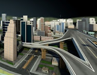
This year, for GIS Day 2011 and consistent with the BIM and GIS themes, I created an on-demand webcast that highlights Autodesk Infrastructure Modeler – a new geospatially enabled, 3D conceptual design tool from Autodesk.
With Autodesk Infrastructure Modeler, explore “what could be” in the context of “what is” whether you’re:
Learn how you can easily evaluate multiple design alternatives in the context of the existing environment by overlaying GIS data and using infrastructure sketching and proposal management tools.
See how you can communicate visually rich proposals of these alternatives with interactive navigations, rendered images, and recorded videos.
Follow this link to access the on-demand webcast and learn more about how you can explore “what could be” in the context of “what is” with this new software from Autodesk: http://www.autodesk.com/modelyourworld
This year, for GIS Day 2011 and consistent with the BIM and GIS themes, I created an on-demand webcast that highlights Autodesk Infrastructure Modeler – a new geospatially enabled, 3D conceptual design tool from Autodesk.
With Autodesk Infrastructure Modeler, explore “what could be” in the context of “what is” whether you’re:
- An architect interested in site development and the placement, orientation and shape of a new building
- A municipal planner examining the impact of new land use and zoning policies on the city skyline and local neighborhoods
- A transportation planner or civil engineer exploring options for a new highway corridor
- A campus authority looking for more compelling, non-technical ways to communicate proposed re-development ideas to project stakeholders
- Someone involved in conceptual design, 3D GIS, or BIM
Learn how you can easily evaluate multiple design alternatives in the context of the existing environment by overlaying GIS data and using infrastructure sketching and proposal management tools.
See how you can communicate visually rich proposals of these alternatives with interactive navigations, rendered images, and recorded videos.
Follow this link to access the on-demand webcast and learn more about how you can explore “what could be” in the context of “what is” with this new software from Autodesk: http://www.autodesk.com/modelyourworld


No comments:
Post a Comment