
 Whether it’s CAD or GIS, we all use a variety of tools to get the job done. One would think though that after more than 20 years, the task of integrating CAD and GIS data would no longer be a problem.
Imagine my surprise then when both of my Unconference Sessions at Autodesk University (AU2010) were filled to capacity.
Each session began by exposing the magnitude of the CAD/GIS integration problem – a billion dollar problem that impacts engineers, contractors and suppliers throughout the planning, design and construction phases. However, these impacts pale in comparison to the many billions lost due to a lack of interoperability by the owner/operators during operation and maintenance phases (NIST).
 Participants were then divided into small groups to discuss their own CAD/GIS integration problems. The results were interesting. Technology it seems was not the main point of discussion. In fact, organizational influences, data ownership, lack of understanding, workflow and standards were the primary factors contributing to an organization’s lack of data integration.
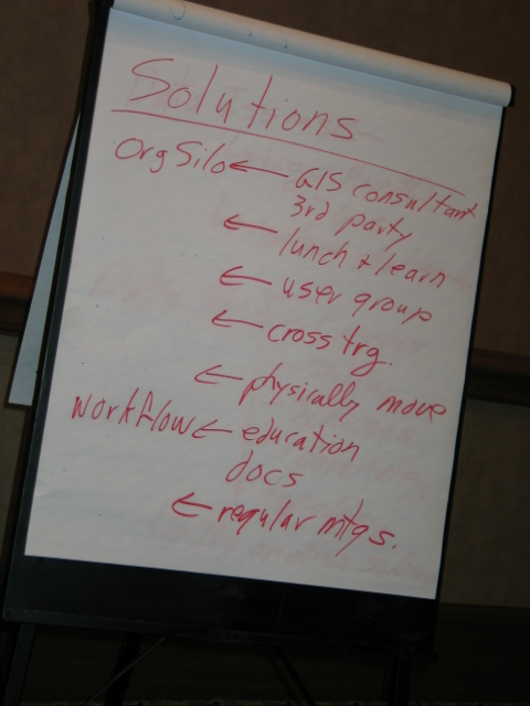
Next, participants were asked to come up with a list of possible solutions. Again, rather than “fix the technology”, discussions centered around solving data related issues and increasing communication, collaboration and education on the CAD/GIS integration topic.

The session concluded by participants sharing their plan-of-action for tackling the issues exposed. In fact, when I asked participants, "Who is committed to tackling the CAD/GIS integration problem within their own organizations?", the vast majority raised their hands in a resounding yes!
If you were one of my session participants or are in the process of tackling your own CAD/GIS integration issues, please share your experiences by sending me a note or including a comment. I would love to hear about your progress.
For more session highlights, please check out Spatial Sustain and Matt Ball's blog on this topic.


No comments:
Post a Comment