Showing posts with label geospatial. Show all posts

Tuesday, November 15, 2011

Model Your World

Last year, in honor of GIS Day, my colleagues and I created a webcast that highlighted Building Information Modeling (BIM) and its impact on the geospatial community. I also blogged about this topic a short time later via GIS User.

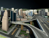
This year, for GIS Day 2011 and consistent with the BIM and GIS themes, I created an on-demand webcast that highlights Autodesk Infrastructure Modeler – a new geospatially enabled, 3D conceptual design tool from Autodesk.

With Autodesk Infrastructure Modeler, explore “what could be” in the context of “what is” whether you’re:
  • An architect interested in site development and the placement, orientation and shape of a new building
  • A municipal planner examining the impact of new land use and zoning policies on the city skyline and local neighborhoods
  • A transportation planner or civil engineer exploring options for a new highway corridor
  • A campus authority looking for more compelling, non-technical ways to communicate proposed re-development ideas to project stakeholders
  • Someone involved in conceptual design, 3D GIS, or BIM
View this webcast to see how you can incorporate existing 2D CAD, GIS, BIM, and raster data to quickly create 3D models that more realistically depict the local environment.

Learn how you can easily evaluate multiple design alternatives in the context of the existing environment by overlaying GIS data and using infrastructure sketching and proposal management tools.

See how you can communicate visually rich proposals of these alternatives with interactive navigations, rendered images, and recorded videos.

Follow this link to access the on-demand webcast and learn more about how you can explore “what could be” in the context of “what is” with this new software from Autodesk: http://www.autodesk.com/modelyourworld

Monday, November 15, 2010

A Cultural Shift in the GIS Industry

In honor of GIS Day 2010, my colleagues Neal Niemiec, Pete Southwood and I have created an on-demand webcast that highlights Building Information Modeling (BIM) and its impact on the geospatial community.

If you’ve never heard of BIM, you’re not alone. Until recently, BIM has been the domain of architects and building owners. However, the application of
BIM has expanded. BIM is now being embraced by municipalities, utilities, transportation departments, campuses and others with an interest in infrastructure; it’s not just about buildings anymore.

A Cultural Shift

BIM is creating a cultural shift in the GIS industry. Geospatial professionals know the power of GIS but many have little knowledge or experience with BIM. Increasingly, geospatial professionals are being asked to integrate BIM models with their GIS data. The task is often a struggle as they attempt to combine the data without losing valuable information. As a result, workflow suffers which compromises efficiency, affects decision making, and impacts data accuracy and currency.

An improved understanding of BIM can help overcome these challenges and ensure that BIM models and geospatial data are integrated in a manner that respects both design and GIS requirements.

If CAD and GIS are the Tools, BIM is the Toolbox

BIM is an integrated process that lets you explore a project’s physical and functional characteristics digitally, before it’s built. Again, BIM is not just about buildings; it’s information modeling for the built environment. As such, BIM encompasses CAD and GIS disciplines by combining model-based design with information and analysis.

BIM is multidisciplinary. It combines the complexity of both built and natural environments. It applies to municipal, transportation, utilities, as well as, campus style environments such as education, health care and airport facilities.

Access this on-demand
webcast:

  • Learn what BIM is and why it’s of importance to the geospatial professional.
  • Discover how BIM helps improve CAD/GIS data integration workflows.
  • See how intelligent model-based design helps promote “GIS Ready” data.
  • Learn how BIM streamlines analysis, visualization and the ability to accurately predict performance, appearance and cost.
  • Discover how BIM improves sharing of digital design information, geospatial data, infrastructure models and other documentation among staff and project stakeholders.
  • Learn how BIM helps extend your GIS asset information into the design/build process to better coordinate with architects, engineers, contractors and others.
  • Learn how to leverage BIM throughout construction, operation and maintenance.
  • Discover how BIM helps you deliver projects faster, more economically and with reduced environmental impact.
  • Learn how BIM reduces risk through a better understanding of a project’s physical, social and economic impact before breaking ground.

Follow this link to access the on-demand webcast and learn more about BIM for the geospatial professional:
http://www.autodesk.com/bimforgis

Tuesday, November 9, 2010

Geospatial Sessions at AU2010

I’ve been looking forward to Autodesk University (AU2010) for a whole year. The event is being held November 30 – December 2, 2010 and that’s only a few short weeks away. My excitement is definitely building. With 600 topics and 400 speakers to choose from and only 3 days to take it all in, I always find it a challenge deciding on which sessions to attend. Usually, I choose topics with a geospatial slant and this year is no exception. Check out the list I’ve compiled below of great geospatial sessions being offered at Autodesk University this year. These sessions offer a wonderful mix of tips, processes, strategies and new ideas for working with design and geospatial data. The topics are varied and cover planning, design, construction and maintenance using AutoCAD Map 3D, Autodesk MapGuide Enterprise, AutoCAD Civil 3D, Autodesk LandXplorer, Autodesk Topobase and more.

UT220-2: A Metadata to Remember: The Importance of Metadata Management for Infrastructure Utility Companies
Speaker: Anthony Neal, Senior Consultant, Autodesk

UT220-1: Sewer Master Planning with AutoCAD® Map 3D and Autodesk® Storm and Sanitary Analysis Extension
Speaker: Dan Leighton, Principal Consultant, DL Consulting

UT223-1U: Autodesk Solutions Add Valuable Situational Awareness for Utility Operations
Speaker: Doug Laslo, Utility Industry Customer Success Manager, Autodesk

UT234-1: Solving Spatial Problems in a CAD-Driven GIS for Telephone Companies
Speaker: Tim Jones, GIS Supervisor, Ponderosa Telephone

CV319-2: Air Force Civil Engineering's Decision to Use AutoCAD® Map for Its GIS Solution
Speaker: Nathan Jaworski, Engineering Contingency Instructor, Red Horse

UT319-2: Optimizing Water/Wastewater Utility Drafting Workflows Using AutoCAD® Map 3D & Autodesk® MapGuide
Speaker: Sean Dingman, Project Manager, Websoft Developers Inc

GS327-1: Spatial Databases with AutoCAD®, AutoCAD Map 3D, and Autodesk® MapGuide®
Speaker: Gordon Luckett, GIS Consultant, Arrow Geomatics Inc.

UT330-1: AutoCAD® Civil 3D® GIS: Migrating Pipe Network Data for Infrastructure Projects
Speaker: Brian Lopez, EMEA Channel Services Program Manager, Autodesk

GS330-1: VanMap, Autodesk® MapGuide® Enterprise, and the 2010 Winter Olympics: A Host City Tale
Speaker: Jonathan Mark, GIS and Topobase Support Manager, City of Vancouver

UT333-2: MidCoast Water: A Case Study on Implementing Autodesk® Topobase™ Client and Web
Speaker: Daniel Watson, ANZ Consulting Practice Lead, Autodesk ANZ

GS416-1: Moving to SQL Spatial: The Whole Nine Yards at Grand Forks
Speaker: Adam Jonasson, GIS Coordinator, City of Grand Forks

UT416-1: Water Companies Integrate CAD and GIS with AutoCAD® Map 3D
Speaker: Anja de Clercq, CAD Coordinator, VMW

GS422-1: Thousands of Raster Files in MapGuide: How Do I Make It Work?
Speaker: Jeremy Robson, Technical Architect, Autodesk

UT430-1: Integrating Autodesk® Topobase™ with Outage Management at the Kansas City Board of Public Utilities

Speaker: Matthew Kreig, Supervisor of Mapping & Drafting. Kansas City Board of Public Utilities

UT220-3U: Migrating to Autodesk® Topobase™ Electric: A Real World Experience
Speaker: Andy Morsell, Consultant, Autodesk, Inc.

UT223-2: Autodesk® Topobase™ Integration Blueprints
Speaker: Pat Byrne, Subject Matter Expert – Utilities, Autodesk

UT231-2: Leveraging Geospatial Solutions for Maximum Benefit at Electric Utilities
Speaker: Allen Beaudette, Electrical Engineer, GL Noble Denton

CP234-1: Autodesk® MapGuide® as a Services Platform: Integrating with Other Applications
Speaker: Giulio Pagan, Senior Consultant, Autodesk

CV319-3U: The Billion Dollar Opportunity: A Workshop on CAD/GIS Integration
Speaker: Michael Schlosser, Geospatial Subject Matter Expert. Autodesk

UT330-2: The Utility Plan-Design-Manage Workflow: A Global Tour of Industry Trends, Projects, and Innovation
Speaker: Alan Saunders, Sr. Industry Manager, Autodesk

UT422-2: From AutoCAD® Map 3D to Autodesk® Topobase™ and Autodesk Topobase Web for Gas Utilities
Speaker: Deeter Smith, GIS Administrator, Okaloosa Gas District

CV223-4: Using Autodesk® Storm and Sanitary Analysis on Large Stormwater Projects
Speaker: Tim Olson, Water Reousrces Design Engineer, Bolton & Menk, Inc.

CV228-1: Autodesk® Topobase™ at the London 2012 Olympics: Managing the Transport Infrastructure
Speaker: Mike Chatterton, Information Knowledge Manager, KBR / Olympic Delivery Authority

UT228-1: Follow the Lines: Best Practices for Utility Projects at the City of Chur, Switzerland
Speaker: Daniel von Kaenel, Delivery Manager, Autodesk

UT330-3U: Process and Information Flow within the Utility Asset Management Life Cycle
Speaker: Kevin Miller, Utility Industry SME, Autodesk

CV416-2: AutoCAD® Civil 3D® and Infrastructure Modeling Solutions: Practically
Speaker: Neil Brooker, Technical Sales Manager, Autodesk

UT419-2U: Risk Management for Utility Industry Projects: The Key to Success?
Speaker: Shashi Verma, Project Manager, Autodesk

UT422-1: Streamlining the Design through Asset Management Workflow at Anchorage Municipal Light & Power
Speaker: Chris Nailer, Technical Consulting Manager, Autodesk

UT433-1: Integrating Autodesk® Topobase™ with Infor™ Hansen Asset Management
Speaker: Joe Chandler, Technical Consulting Manager, Autodesk

CV220-3P: Claiming New Territory with Autodesk® LandXplorer®
Speaker: Dan Campbell, Manager – Graphics & Communication, City of Vancouver

CV223-3P: Raster Images, Elevation Models, and Point Clouds in AutoCAD® Map 3D and AutoCAD Civil 3D®
Speaker: Nathan Moore, GeoSpatial Support Analyst, Autodesk

UT228-2: Implementing an Enterprise-Class Telecommunications Network Design Tool
Speaker: Casey van der Grient, VP Business Development. SPATIALinfo

CV231-1: Slope Stability Analysis with AutoCAD® Civil 3D®
Speaker: Donal McMoreland, Civil Applications Engineer, amicus technology

CV234-4: FDO: CAD's Best Friend
Speaker: Gary Rosen, Regional Civil Sales Director, Carlson Software

CV319-1P: Understanding the Spatial Analysis Tools: Buffers, Overlays, and Topologies in AutoCAD® Map 3D
Speaker: neal niemiec, Geospatial Technical Specialist, Autodesk

UT322-2: Using and Optimizing Storm and Sanitary Analysis 2011 in a Consulting Engineering Environment
Speaker: Charles Ogden, QA Analyst, Autodesk – Contractor

CV327-1: AutoCAD® Civil 3D®: The Ten Commandments of Survey Data
Speaker: Creg Dieziger, Senior Engineering Technician, Morrison Maierle, Inc.

CV327-6: Solving the Grid-to-Ground Problem with Custom Coordinate Systems
Speaker: Richard Sincovec, President, Quux Software

APICP330-2: Build Powerful Workflows Using the AutoCAD® Map 3D 2011 Workflow Framework
Speaker: Gopinath Taget Raghunathan, Developer Consultant, Autodesk

CV330-1P: Surface Modeling and Analysis Using Real-World Data in AutoCAD® Civil 3D®
Speaker: Stefanie Self, Civil Engineer, Office of Surface Mining

CP228-1: Autodesk® MapGuide® MapAgent: The Secret Renderer
Speaker: Jeremy Robson, Technical Architect. Autodesk
Wednesday, July 21, 2010

Cadalyst Article on How to Work with Point Clouds

Here's a short post on my latest Cadalyst article. This article focuses on one of my favorite new features in AutoCAD Map 3D 2011: the new point cloud tools for viewing, querying and analyzing 3D laser scanning and LiDAR data sets. I have also posted a video to accompany the article.

Please be sure to check out both the article and the video.

Wednesday, February 17, 2010

Cadalyst Article on CAD Queries with AutoCAD Map 3D

Here's a short post on my third Cadalyst article. This article focuses on how to query your AutoCAD drawings with AutoCAD Map 3D. I have also posted a video to accompany the article.

Please be sure to check out both the
article and the video.

Thursday, November 19, 2009

Cadalyst Article on Geospatial Queries with AutoCAD Map 3D

Here's a short post on my second Cadalyst article. This article focuses on how to create feature data queries with AutoCAD Map 3D. I have also posted a video to accompany the article.

Please be sure to check out both the
article and the video.

Thursday, August 13, 2009

Learn Geospatial Analysis at AU2009

Autodesk University 2009 (AU2009) will be held December 1-3, 2009 at the Mandalay Bay Resort, Las Vegas. AU2009 is one of my favorite learning events of the year and the perfect opportunity to connect with professionals from all over the world and explore new ideas, technologies and workflows. Early registration for AU2009 commenced on August 12.

I’m thrilled to be participating at this event and happy to once again have the pleasure of facilitating a class on geospatial analysis. If you are an engineering, CAD or GIS professional; if you are an existing AutoCAD Map 3D user; or simply interested in learning how to analyze your CAD drawings and geospatial data; check out my 90-minute class entitled, “Analyze This! How to use AutoCAD Map 3D for Geospatial Analysis”. The topics that will be covered include:

  • Enhanced overlay capabilities and the new workflow framework
  • Databases, tabular joins and the expression builder
  • Thematic mapping techniques
  • Geospatial buffers and point, line and polygon topologies
  • 3D surfaces
If you have a preference for the type of analysis that you want discussed and demonstrated during this class, please register your vote in the polling question entitled, Pick your AU2009 Topic, which is located to the right of this post and/or leave a comment.

If you’re going to be attending AU2009, be sure to register for Class ID: GS314-2 and please say “Hi”. I look forward to meeting you!

Sunday, August 2, 2009

How to use Negative Distances in your Geospatial Buffer Analysis

Geospatial buffer analysis involves generating a polygon at a specified distance from a proposed feature to determine proximity. For example, a 100m buffer around a point feature creates a circle with a 100m radius. Similarly, a 50m buffer around a polygon feature creates a larger polygon – a polygon that encompasses the source feature.

However, did you know that you can also use a negative distance to create a buffer? That’s right! When you use a negative distance, such as -25m, to buffer a polygon feature, the result is a smaller polygon – a polygon that is inside the source feature.

Consider the following example where the objective is to determine the area of shoreline habitat available for a certain species of wildlife. The species in question has been observed not to forage beyond 100m from shore and includes a riparian buffer of 25m as part of its habitat. To compute the total area of habitat available to this species requires the creation of two buffers and a polygon overlay operation. The first buffer (ie BufferOutside25) is created at a distance of +25m and represents the riparian buffer. The second buffer (ie BufferInside100) is created at a distance of -100m and represents the forage extent. A polygon overlay analysis of type subtract is then used to determine the zone of available habitat where:

HabitatZone = BufferOutside25 – BufferInside100

The total area of habitat available is equal to the area of the zone of available habitat (ie HabitatZone).

Check out the video to see the process in action with AutoCAD Map 3D.

Monday, July 20, 2009

Engineering GIS in LEED for Neighborhood Development

Leadership in Energy and Environmental Design (LEED) is a certification program that encourages the adoption of sustainable design, construction and operation practices as applied to buildings and communities. Think of LEED as a way of promoting a green approach to community development.

From a civil engineering perspective, LEED for Neighborhood Development (
LEED ND) is an opportunity to bring together engineering design and GIS analysis methods in order to meet a set of documented requirements for achieving LEED certification. For example, the Smart Location and Linkage category encourages brownfield developments to reduce urban sprawl. Maximum credit can be attained if the project is located in a previously developed infill site that is also in a high-density area. In this case, high-density is a function of the number of street intersections within a half-mile of the project boundary.

To determine how well a project complies with these criteria, we can apply an
Engineering GIS approach that leverages both CAD and GIS data. First, rather than using an import/export method to bring together the required data, FDO data providers are used to connect the GIS-based parcel and street centerline data to the CAD-based site design. Next, a geospatial buffer is created at a distance of a half-mile from the site boundary. The buffer is used to determine proximity and involves generating a polygon at a specified distance from the proposed site boundary. Finally, in this simplified example, a geographic query is used to determine the number of intersections within the buffer and this number is compared to the LEED criteria.

Some of the benefits of this approach include the following:

  • Data conversion and data redundancy can be avoided as a result of using FDO data providers to connect to the data directly rather than relying on an import/export process.

  • Efficiency is improved as a result of applying an approach that embraces CAD tools for site design and geospatial tools for analysis all in one software platform.

  • Better designs are possible because more design alternatives can be evaluated against LEED criteria.
Check out the video to see the process in action using AutoCAD Map 3D.


Friday, July 10, 2009

Cowboys, Barbeque and Geospatial Analysis

Yee Haw! It’s Stampede Week in Calgary, Alberta and what better way to celebrate than to combine Stampede attire (ie cowboy hat, jeans, big belt buckle and boots) with a seminar on Geospatial Analysis. Well, it seemed like a crazy idea; however, the folks at Autodraft, Inc have a great sense of fun. So, when I was given the opportunity to talk about my favorite topic of Engineering GIS and CAD/GIS integration, I jumped at the chance.

In spite of the Stampede traffic, the rain and the tornado watches, folks came out in droves to learn how to analyze their CAD drawings and geospatial data using the powerful geospatial analysis tools found in Engineering GIS. With the help of my pardner "Cowboy Bob", we delivered a seminar entitled "Geospatial Analysis for the Egnineering and CAD Professional". We used AutoCAD Map 3D, AutoCAD Raster Design and Autodesk Topobase to demonstrate numerous geospatial techniques including…

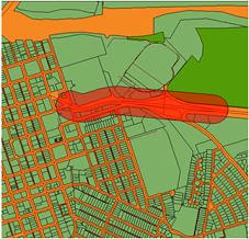
Sample Buffer Analysis performed with AutoCAD Map 3D
  • Queries and how to use them to get more information from CAD drawings and GIS data sources
  • Drawing cleanup tools and why they are necessary to ensure the accuracy and correctness of CAD and GIS data
  • Topology, it’s importance for CAD and GIS users alike and how to create topologically correct features
  • Spatial analysis such as network traces and their use with CAD and GIS data
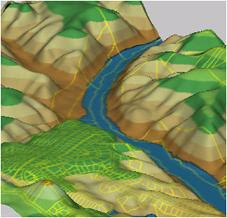
  • Polygon overlay and its power to reveal new patterns in CAD and GIS dataSample 3D Surface Analysis performed with AutoCAD Map 3D
  • Buffer analysis and why it’s sometime the best way to determine spatial proximity
  • 3D surfaces and how to analyze them for height, slope and aspect
  • Raster to vector conversion and how to combine scanned CAD drawings, maps and aerial imagery with vector-based CAD and GIS data
  • And more…
After the presentation, we all moseyed on down to the Autodraft corral for a great Stampede barbeque, refreshments and conversation.

A fun and informative Yee Haw time was had by all!


Saturday, March 7, 2009

GIS Skills for the Engineering and CAD Professional

ENGIS: It's not Engineering or GIS; it's Engineering and GIS!
Last week I had the pleasure of visiting Calgary, Alberta and facilitating a half-day seminar aimed at demonstrating the crucial GIS skills needed by engineering and CAD professionals. This well attended seminar, hosted by Pacific Alliance Technologies, highlighted the differences between CAD and GIS workflows, reviewed the obstacles to CAD/GIS integration and discussed the importance of an Engineering GIS approach.

I was expecting the audience to consist mainly of engineering and CAD folks. So, I was surprised to discover that there was a 50:50 mix of both CAD and GIS professionals. It turned out that some of the geospatial participants were looking for a better understanding of CAD related workflows. They also wanted information on how to work and better communicate with their engineering and CAD counterparts so that they could potentially simplify their geospatial data integration tasks and drive productivity. Similarly, some of the engineering and CAD participants were seeking pointers on how to overcome resistance to GIS within their own engineering organizations.

So, why is there this resistance to GIS by some engineering firms?

Well, engineering is about design; it’s about creating documents that have the exact amount of detail necessary to construct what was designed and then ensuring that construction proceeds according to specification. To these firms, construction represents completion and so their design documents and as-built drawings reflect that.

However, according to the National Institute of Standards and Technology, the cost of inadequate interoperability for U.S. capital facilities during the operation and maintenance phases is estimated at $9 billion US. If you include infrastructure, like bridges and roads, then these costs sky-rocket even further!

Design documents and as-built drawings must be created with a new end in mind.

Engineering and CAD professionals must create their design documents in such a way that the embedded geospatial data can be utilized throughout the infrastructure lifecycle. Design data must be easily integrated with corporate databases so that this information can be used during infrastructure operation and maintenance activities. Engineering GIS can help.

As the original creators of our infrastructure data, I believe engineering and CAD professionals have a responsibility to ensure that this information can be easily integrated throughout the infrastructure lifecycle. To do otherwise, simply contributes to the billions of dollars already wasted due to the lack of interoperability and poor data integration.

Monday, January 19, 2009

The Five Principles of Engineering GIS

Have you ever rummaged through your toolbox looking for that certain tool only to find that you stored it somewhere else? If you have then you know how frustrating and inefficient it can be.

Well, when it comes to CAD and GIS, traditional thinking separates design tools from geospatial tools into different packages. When you’re faced with working in both domains, however, you end up switching back and forth between those packages. This means you also need to pass the data back and forth. The process is error prone and not very efficient.

Engineering GIS combines CAD and GIS capabilities into a single unified toolset. That is, the engineering design, data creation and editing tools of CAD are combined with the database, analysis and spatial data management tools of GIS.

There are five key principles of Engineering GIS:

1. Data passes through a lifecycle. Engineering GIS recognizes that data passes through a lifecycle. For example, when working in the municipal infrastructure domain, data moves through various phases from surveying and mapping, to design and construction, and finally to management. Engineering GIS assumes that the design information will be used in different ways by many people downstream from the engineering design process. Consequently, engineering drawings are topologically correct and “GIS ready” which streamlines the task of incorporating this information into an infrastructure management system and a geospatial database.

2. Access data natively. Engineering GIS recognizes that data comes in many different formats and from many different sources including traditional engineering and GIS environments, spreadsheets and databases, as well as, desktop and web-based sources. However, rather than relying on a data import/export process, Engineering GIS promotes working with the data in its native format. Consequently, data integrity is maintained, data redundancy is reduced and efficiency is improved.

3. Leverage design tools. Engineering GIS leverages CAD and engineering design tools because of their precision and ease of use for data creation and maintenance of engineering design features, as well as, mapping and other geospatial data.

4. Leverage geospatial tools. Engineering GIS leverages GIS tools because of their data oriented capabilities for automated mapping, spatial analysis and management of geospatial databases.

5. Renderings must be accurate. Whether printed to paper or published to the Web, Engineering GIS ensures that drawings and maps are accurately rendered with the point, line and polygon styles, raster and vector overlays, symbology, dimensioning and overall appearance that users expect.


As you can see, with Engineering GIS, you don’t have to choose between CAD and GIS software because both types of tools are available in one place. Together, they create a toolset that simplifies engineering and geospatial data integration.

Until next time...why not take a moment to geoExpress yourself?

Wednesday, January 14, 2009

CAD and GIS like Milk and Cookies

Milk and cookies - just plain good! There’s something about pairing the crunchy sweetness of cookies with a refreshing glass of milk that not only tastes great but satisfies too. Some things are meant to be together.

I think that CAD and GIS are kind of like that; I think CAD and GIS are meant to be together.

If you are an engineer or a drafting professional, you know all about CAD. You know the value of using CAD for engineering design and drafting; you know that when it comes to producing accurate drawings for construction purposes, CAD is the right tool for the job. In fact, there’s no better tool.

However, as an engineer, you may also have a need to place your designs within a geospatial context; you may need to combine design information with geographic data and you may need to examine your designs using spatial analysis techniques. In fact, attribute data, raster imagery and thematic mapping may help you to better design and visualize your infrastructure projects.

Traditional thinking separates design workflows from geospatial workflows. Consequently, you stick to what you know. With little experience in GIS or little time to learn new technologies, a choice is made; you focus on design and let someone else handle the geospatial stuff.

Unfortunately, this approach results in a disconnect between design departments and GIS departments, and between CAD data and GIS data. Consequently, workflows suffer which compromise efficiency, affect decision making, and impact data accuracy and currency.

However, there is an alternative: a unified approach called Engineering GIS that embraces both engineering design and GIS. Engineering GIS together with an improved understanding of how GIS skills can complement existing design skills can help overcome those workflow challenges and ensure that CAD and geospatial data are integrated in a manner that respects both engineering design and GIS requirements.

CAD and GIS like milk and cookies – just plain good.

Stay tuned as I elaborate on the importance of an Engineering GIS approach in future posts. I’ll also highlight some of the challenges encountered when attempting to integrate design information with geospatial data and I’ll review the key skills that you need in order to take advantage of Engineering GIS.

Until then… remember to geoExpress yourself.

Wednesday, January 7, 2009

The Road Ahead: Time for Change

Happy New Year and welcome to geoExpressions!

For many people, now is the time to think of the road ahead – the time for making New Year’s resolutions. Yet, while some people vow to get more exercise, strive to lose weight or promise to quit smoking, I committed to writing a blog. Ok – I have to admit; even though I have written and published several papers and presented numerous conference presentations about CAD and GIS throughout my career, geoExpressions is my first blog and this blog entry is my first post.

As an engineer who has worked in the GIS industry since 1988, I have witnessed the evolution of design drafting from pencil and paper to computer aided drafting to model based design. I have seen CAD evolve from a drawing only environment to one that embraces geospatial data and databases. Today’s CAD has changed.

And yet, I still see many engineering, CAD and geospatial professionals continue to limit CAD to the realm of design drafting. Consequently, for many organizations, paper is still the prevalent output medium for maps and drawings; integration of CAD and GIS data means an inefficient import/export process; and analysis involves loading the data into spreadsheets or handing the data over to geospatial gurus. Ultimately, these outdated workflows result in decreased efficiencies which negatively impact budgets and business objectives.

As local governments, utilities and other organizations design, build and manage our above- and below-ground infrastructure in the face of ever increasing infrastructure deficits, it is imperative that we find new ways of doing things. The more dollars we save; the more dollars we can put towards repairing our roads, bridges, water mains and other infrastructure.

For my New Year’s resolution, I have committed to writing this blog because of a need for change... a more efficient way of expressing my thoughts on the engineering and geospatial challenges still encountered by many organizations.

And so, when you look at the road ahead, if you are frustrated by CAD and GIS integration, if you are looking to put more dollars towards maintaining the roads rather than on outdated and inefficient workflows, make a New Year’s resolution; challenge the status quo and commit to new ways of doing things.

Until next time... go ahead... take a moment to geoExpress yourself!